 |
 |
|

This is a relatively easy loop hike that incorporates two of the canyon's most popular trails and a well-travelled section of the Tonto trail. And the views are spectacular. The South Kaibab never ceases to impress with its wide open vistas. The hike along the Tonto presents the South Rim from an entirely different perspective than one gets along the popular rim trail. Hiking from Indian Garden to the South Rim via the Bright Angel trail offers an education in Grand Canyon geology.
Dennis Foster joined me for this hike. Wanting to avoid being the Tonto during the hottest part of the day, we decided to get an early start. I picked up Dennis about 4:15 AM and we rolled into the parking lot at the Bright Angel trailhead about 90 minutes later. We quickly collected our gear and hoofed it to the bus stop outside Bright Angel lodge just in time to catch the 6:00 AM hiker's shuttle for the South Kaibab trailhead. The shuttle took a good 20 minutes to the get to the trailhead, which put us on the South Kaibab at 6:30 AM. Much of the descent through the Kaibab formation was still in the shade but the rest of the canyon was awash in the golden-hued, early morning light.
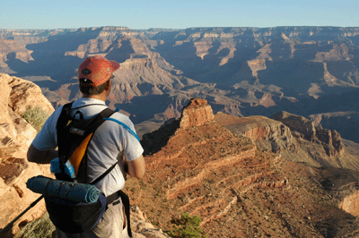
We made good time through the Kaibab and along the traverse through the Toroweap, arriving at "Ooh Ahh Point" after about 20 minutes. A couple of hikers were there watching the sunrise over Grand Canyon. Dennis and I stopped briefly to take some photos then continued down the trail. The switchbacking descent through the Coconino sandstone may be my favorite section of this trail. It's along this stretch that the wide open canyon vistas first present themselves and it's nothing short of astounding. It would be easy to fill an entire flash card along this portion of the South Kaibab. But Dennis and I had something of a schedule to keep so we pushed on without too much delay. It was 7:25 AM when we arrived at Cedar Ridge.
Here, we paused for a short break to eat a snack and drink some water. We met a group of three backpackers who were on their way to Phantom Ranch and the Bright Angel campground. We also met a solo hiker en route to the same destination. From his accent, I would guess he was from Germany or Austria. He was kind enough to take a photo of me and Dennis, and we, of course, returned the favor. We crossed paths regularly with all four during the hike to the South Kaibab-Tonto junction.
After our break, Dennis and I began the traverse below O'Neill Butte as we headed for the descent through the Redwall. It's interesting, there are two sections of trail on the Bright Angel that have well-known nicknames. Jacobs Ladder takes you through the Redwall, and the Devil's Corkscrew switchbacks through the Tapeats and Vishnu schist. The descent through the Redwall on the South Kaibab is a challenging section of trail but it has no nickname; at least, none that is widely known. I asked Dennis if he knew of a nickname for this portion of the trail and he said a hiking buddy of his refers to it as the "Red & Whites." I wonder if there are other pet names for this route through the Redwall?

It was about 8:00 AM when we arrived at the top of the "Red & Whites," where we could see several hikers and a mule train below us on the switchbacks. We paused a few minutes for another snack and to check out the Old Miner's route, which we'd hiked during our March trip to Clear Creek. The Old Miner's route leads through the schist from the River trail to the Tonto platform, reaching the platform about a half-mile east of the solar outhouse where the South Kaibab and Tonto trails intersect. The descent to the Tonto was fully in the sun but it didn't matter as the tempertaures were still well below 90 degrees, at this time of the morning. During the descent, we passed the sign marking roughly the halfway point between the rim and Phantom Ranch. The time was approaching 9:00 AM when we reached the Tonto junction.
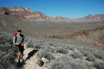
We paused just long enough for me to take some photos of a mule train waiting at the solar toilet. I also grabbed a shot of a lone hiker who'd made the turn west on the Tonto just as we arrived at the intersection. About ten minutes into our hike along the Tonto, we met a Grand Canyon park ranger. He was hiking the same route as Dennis and I, but going in the opposite direction. While we chatted, the ranger mentioned that he'd seen a couple of rattlers in the reeds at Burro Spring. And with that bit of information, we continued down the trail.
Fifteen minutes of hiking brought us through a minor drainage below the northern face of O'Neill Butte. And as we hiked upslope to the northwest, we used my mini-binoculars to scan the rim across the drainage, spotting a large cairn. Shortly thereafter, I noticed a second cairn in the same area. Initially, we thought this was the cairn we'd found, last March, upon reaching the Tonto on the Old Miner's route. However, despite the appearance of a short switchback below the rim, the Tapeats did not seem to offer an accessible route descending any further. Dennis used my binoculars to scan further along the opposite rim until finding another cairn closer to where we remembered emerging onto the Tonto platform. This new cairn was at the head of a drainage that appears to offer relatively easy access to a saddle at the top of the schist. This was the cairn we'd found; that was obvious. But what of the other cairns; do they mark another route?
This section of the Tonto Trail presents some fine views of prominent Grand Canyon landmarks, including Cheops Pyramid, Isis Temple and the Tower of Set north of the Colorado. We were also able to see the roof and exterior of the Yavapai Observation Station along the South Rim. The hike into Pipe Creek offers intriguing peeks into the drainage that pours into Garden Creek en route to the Colorado River. Harvey Butchart's canyon map shows routes into Pipe Creek from several access points. And from near the west rim of pipe creek, there are granaries and other Indian ruins visible below the Tapeats.

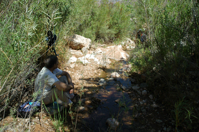
Shortly after resuming the trail, we caught and passed the young solo hiker, exchanging pleasantries along the way. It was just after 10:00 AM when Dennis and I arrived at Burro Spring. We passed through the reeds--crossing a lightly flowing stream in the process--but did not encounter any rattlers. Fifteen minutes later, we made it to Pipe Creek. There's a large shady area in the trees just above the creek's west bank, but Dennis and I opted to have a seat right next to the water where we could soak our feet while having a snack. The young man we'd met and passed a short time earlier arrived a few minutes into our snack break and we invited him to join us. Over the next 30-45 minutes, we chatted and exchanged stories. Our new friend was spending the summer riding his bicycle throughout the Southwest. He'd left his home in Oakland six weeks before, and made stops at Yosemite, Great Basin National Park and Bryce Canyon, before reaching the North Rim of Grand Canyon just a few days ago. His name was Dionne and we enjoyed his company at Pipe Creek.
It was about 11:15 AM, when Dennis and I resumed the hike west along the Tonto. By now, the heat of the day had reached a level that made us glad we would soon arrive at Indian Garden. During the hour-long trek, we stopped briefly to use my binoculars to check out the ruins below the Tapeats in Pipe Creek. Further in the distance, we could see Sumner Butte and Zoroaster Temple. It was nearly noon but the sky still seemed quite clear. The typical midday haze had not developed, which made the broad vistas up and down the canyon even more spectacular than usual. Finally, at just after 12:00 PM, we reached the intersection with the Bright Angel trail alongside Garden Creek. By now, the sweat was freely flowing and I was ready for some fresh water and shade.
Dennis and I arrived at the water station near the Indian Garden toilets at 12:15 PM. It was a crowded scene with mule travelers, backpackers and day hikers filling the benches. We found a flat rock and a patch of ground near the water spigots and settled in for a long break. I ate my second sandwich, followed by an apple with peanut butter, some tapioca pudding and a totally melted Hershey's chocolate bar with almonds. Oh, I also fended off several assaults by the fat Indian Garden squirrels. They are pesky little critters. The food and water were good but what I really wanted, was to soak in the cool waters of Garden Creek.
While Dennis napped, I hiked back down the trail a short ways until I found a well-travelled access route to the creek. Here, Garden Creek cut a deep trench into the earth. The walls were vertical and about five feet high. At the upstream end of the trench, the water spilled over a four-foot falls. The falls emptied into a long, narrow pool that, due to a manmade dam of rocks, ran about 2 1/2 feet deep for some 30 feet beyond the falls. I deposited my backpack, hiking poles and boots beneath the low branches of a tree near the trench. Donning my water shoes, I climbed down into the creek and waded upstream to the falls. The water rushing over my head and back was cold, crisp and immediately refreshing. Thoroughly soaked, I walked downstream to some flat rocks and sat with my legs in the creek. Scooping handfuls of chill water, I rinsed the trail dust from my legs, arms and face. I splashed more water over my head, removed and soaked my T-shirt and also drenched a neckerchief, which ended up around my head. I then settled into the creek, sitting in the water with my back against a large rock. The next fifteen minutes were pure heaven.
At 1:30 pm, I scrambled from the creek and got myself together for the hike to the rim. Fifteen minutes later, I arrived back at the water station where Dennis also was readying for the push up the Bright Angel trail. We refilled our Camelbaks with fresh, cool water and were on the trail a few minutes later. Leaving the shade of Indian Garden, we emerged into the midday heat. The view up-canyon revealed a trail that was totally exposed to the sun throughout so, we resigned ourselves to the hot task at hand. We weren't in a hurry so, with no need to rush, we settled into a slow and steady pace for the hike to our first goal; 3-Mile Rest House.
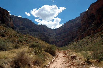
During the first, relatively flat stretch of trail between Indian Garden and the foot of Jacob's Ladder, we discussed strategy for our ascent to the rim. We both had enough water to make it to 1 1/2-Mile Rest House. Dennis recalled that the water at 3-Mile tends to be quite warm. Also, 3-Mile doesn't offer as much shade as 1 1/2-Mile. So, we planned to push on to 1 1/2-Mile Rest House, provided we were in good shape at the top of the Redwall. Thirty minutes after leaving Indian Garden, we arrived at the beginning of the ascent through the Redwall. This section of trail includes Jacob's Ladder, a series of switchbacks that leads to 1 1/2-Mile Rest House. Observant hikers may notice a U.S. Geological Survey benchmark along this stretch of the Bright Angel. The benchmark indicates an elevation of 4,610-feet with 2,256-feet in vertical elevation to gain before achieving the South Rim.
We arrived at 3-Mile Rest House some 55 minutes after leaving Indian Garden. As expected, the water was too hot to stomach. But it was still wet so, we stopped to soak our heads, shirts and neckerchiefs before continuing the climb. There were several grumpy day hikers at the rest house. They were obviously disappointed at the unpleasant condition of the water. It's interesting how perceptions of something like that can differ, if you know what to expect. In any event, we weren't at the rest house more than 5 minutes before resuming the trail.

During the hike to 1 1/2-Mile Rest House, we spotted a familiar sight; the flagpole outside the El Tovar hotel. Sights such as this can serve as much-needed inspiration for a tired hiker. A familiar landmark, building or sound--steam train whistles at Grand Canyon Depot--serve as indicators of real progress toward the ultimate goal. As we climbed through the Coconino sandstone, we also began to encounter more day hikers; another sign that we were nearing the rim. There was also a nice breeze and some strategically placed afternoon clouds provided regular and much-appreciated relief from the glaring sun. At just before 3:00 PM, we ascended to 1 1/2-Mile Rest House, continuing past the toilets to the water station, where we found a place in the shade to drop our packs. Again, I soaked my head, shirt and neckerchief before settling in for a 15 minute break and a snack.
Most of the people stopped here were day hikers, although I'm sure few others were into double-digit miles on the trail, as Dennis and I were. There were also quite a few international visitors. We heard French, German, Spanish and other languages while recovering at the rest house. Refreshed and ready for the final ascent, Dennis and I hit the trail at 4:20 PM to begin the push to the rim. By now, much of the trail was in the shade and a cooling breeze made this last section of trail even more enjoyable. We were both feeling surprisingly energetic. In fact Dennis was in such good spirits, that he doubled his hiking pace as we approached the last switchback on the climb through the Kaibab limestone.
We arrived at the trailhead about 5:15 PM, having covered 13.5 miles in Grand Canyon. Before reaching the rim, I'd stopped to get some shots of the Kolb Studio and also a few photos looking back along the Bright Angel toward Indian Garden and Plateau Point. We made a bee-line for my Isuzu Rodeo, where we donned clean shirts and more comfortable shoes. After changing, we walked over to the Arizona Steak House at the Bright Angel Lodge for a delicious meal at a table with a great view of the canyon. It was the perfect ending to a really great day at Grand Canyon.
Bill Ferris
Flagstaff, Arizona
 |
 |
 |