
 |
 |
|
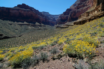
I was hiking the easy part of Boucher Trail, the Supai traverse along the west rim of Hermit Canyon. Rounding a corner, I saw four hikers taking a break in what little shade there was on this stretch of trail. The guy in the blue shirt spoke, first. "About how far to the scramble from here?"
"The descent through the Supai?" I asked.
The guy who'd asked about the scramble looked at his shirtless friend who responded, "No, where the trail goes into Travertine Canyon; how far 'til that?"
"Yeah, that's the descent through the Supai," I corrected. "I was there about an hour ago."
"What was it like? Was the trail easy to follow?" This was the first guy, again, and there was just a hint of concern in his voice.
"It was easy enough to follow; well used and an occasional cairn. Better going up than going down, I suspect. There's a nice flat section between the base of the Supai and the top of the Redwall by White's Butte. Then, it's pretty steep all the way to Boucher." The shirtless guy was nodding and a third guy was just sitting on the ground with his head down.
The guy in the blue shirt asked, "What time did you get started?"
"I left Boucher at 5:30 am." That was 4 1/2 hours ago and these trail-weary hikers seemed to understand what lay ahead for them. But it was the first guy who summed it up.
"Wish we'd gotten started earlier. We're gonna fry, today."
Hey, that's hiking in Grand Canyon. We always wish we'd gotten an earlier start, especially when hiking a steep section of trail in the heat of the afternoon. My 5:30 am start from Boucher camp had paid huge dividends. I'd made the ascents through the Tapeats, Muav, Redwall and Supai in the shade. Although I'd worked up a good lather on those climbs, I was still feeling strong and making good time through the Supai when I met the group resting by the trail. Nearly 2 1/2 hours of sometimes hard hiking lay ahead but, at that time and in that place, I was cruising.
Four days before on Saturday, April 18, I'd pulled into the Hermits Rest hikers' lot at 8:50 am. I had just enough time to collect my gear and give the Rodeo the once-over to make sure I wasn't forgetting anything. About five minutes later, Chris Forsyth pulled in and I transferred my gear to his vehicle. With my SUV locked and patiently awaiting my return via the Hermit Trail some five days hence, Chris and I began the nearly two-hour drive to the South Bass trailhead.
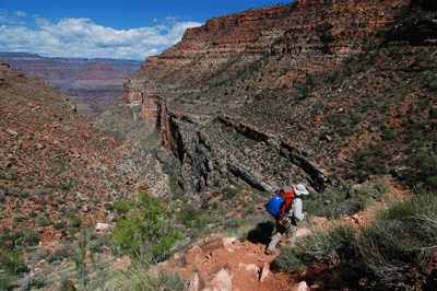
Forest Road 328 rolls west for about 16 miles until reaching the gated entrance to the Havasupai Indian Reservation. It was nearly 10:30 am when we pulled up and called out to announce our arrival. Nobody was around so, we got out and walked towards the house. The attendant appeared--shirtless--in the window and announced that he'd be out in a minute. We waited by the vehicle until the man--now wearing an official-looking shirt--walked out to greet us. He accepted the $25.00 entrance fee, opened the gate and wished us well as we pulled through. Thirty minutes later, we pulled into the crowded South Bass trailhead parking area.
I counted seven vehicles at the trailhead. A large group of hikers had just rimmed out and were preparing to depart for home. Soon after this group departed, Chris and I left the parking area and began hiking down South Bass. South Bass isn't an easy trail--not by any stretch--but is far from the most difficult south rim trail. The trail descends along an easterly route through the Kaibab and Toroweap. Just 1/2-mile into the hike where the trail turns generally northward, we spotted granary ruins above the trail in the Toroweap. We stopped for a few minutes to explore the ruins but, soon enough, we were back on the trail and making a relatively easy descent through the Coconino. As the trail passed through the Hermit on its gradual descent toward the river, we were treated to some fine views of the Esplanade and Mt. Huethawali.
We set foot onto the Esplanade about 12:15 pm and found a place in the shade for an extended snack break. While noshing on trail mix and jerky, we were visited by a gentleman who was packing light, wearing just a hydration bladder. He was meeting some friends he'd dropped off at the trailhead the previous week. After a brief chat, he continued downtrail. Chris and I resumed the trail at 12:50 pm, making short work of the Esplanade and starting the descent through the Supai shortly thereafter. It's here that the South Bass makes a hairpin turn to the right, heading southward into Bass Canyon towards the Redwall descent.
We arrived at the cairned descent at 1:43 pm. Just ten minutes of relatively easy hiking through a natural break in the Redwall delivered us to the Muav where the trail became much less steep and we found a place for a lunch break. It was 2:00 pm. After 30 minutes and a really yummy salami and cheese sandwich, it was time to resume the hike. Fifteen minutes later, we were stopping for pics at the junction with the westbound Tonto Trail. Five minutes after that, we reached the junction with the eastbound Tonto.
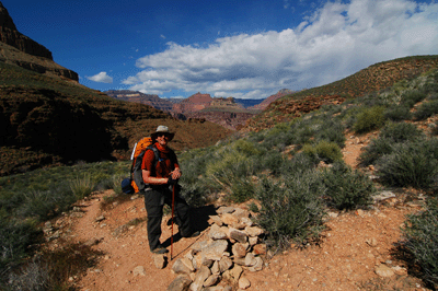
My plan for the night was to make a dry camp on the Tonto west of Serpentine. Having read accounts of hikers getting the runs after drinking Serpentine water, I intended to carry enough water to reach Ruby Canyon. So, I needed to top off my Camelback and water bottles before leaving Bass Canyon. Chris recalled seeing pothole water in Bass Creek just below the eastbound junction and, sure enough, there was a pothole filled with lime green water. It was usable but I wasn't ready to commit just yet. Since Chris was continuing on to the river, I decided to tag along. I'd be able to see the Ross Wheeler and, along the way, could look for more appealing water in Bass Creek. Carrying just my pack, water containers and filter, I left the goopy pothole at 3:43 pm bound for the Colorado River.
My strategy paid off, doubly. About 15 minutes downstream of where I'd cached my gear, we passed a large pothole in the Schist that was filled with clear water. This was near the place where a shortcut route leaves the creek bed and ascends a gradual debris slump to the westbound Tonto. I made a mental note of the location and planned to stop there to tank up on water on the way back from the river. Continuing down South Bass, we soon rounded a corner as the trail turned north to parallel the river. At 4:15 pm, we reached the cairned descent route to the beach at Bass Rapids and hustled on down for a quick look at the Ross Wheeler. After snapping a few quick pics--this was literally a five-minute stop--we headed back up the route to the main trail.
As late as it was in the day, I was itching to begin the trek back to my gear. I still had a lot to do: filter water, re-pack my gear and hike at least a mile along the Tonto before setting up camp for the night. So, I thanked Chris for the ride to the trailhead. We wished each other well and went our separate ways. Chris continued along the South Bass to the ferry beach and I headed back up the trail. It was 4:45 pm.
Almost as soon as I reached the creek bed I lost the main trail. But I stayed on a lesser-used cairned route and eventually rejoined the main trail. At 5:25 pm, I arrived back at the large water pothole in the Schist and spent 20 minutes filtering the better part of 4 liters. Leaving the pothole at 5:45 pm, I continued up South Bass to the green water pothole, arriving there at 6:00 pm. It took just 15 minutes to reload my gear in the Aether 70 and I was back on trail at 6:15 pm. Five minutes later, I reached the cairned junction with the eastbound Tonto Trail and, turning east on the new trail, my trek through the Gems was begun.
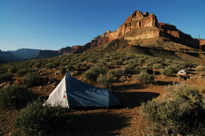
I got as far as the point below Grand Scenic Divide overlooking Bass Rapids before darkness and exhaustion convinced me to stop for the night. The spot I chose was an open area that had obviously been used as a campsite by others. One of my predecessors had used rocks to make a small seat and tables perfectly suited for a cooking stove and cup. It was 6:48 pm when I stopped to pitch my tent. The Mountain Hardware Sprite I went up quickly enough. But inflating the Big Agnes pillow and Air Core sleeping pad always seem to take a long time. Next, came dinner which consisted of Mountain House pasta primavera, hot apple cider and a small Hershey's chocolate bar with almonds. I climbed into my tent and managed to finish a journal entry before sleep claimed me. It was 6:00 am when I crawled out of my Cross Mountain 40 to start the second day of my hike.
The sunrise was lovely. I walked downslope to the edge of the point overlooking Bass Rapids. The beach across the river above Shinumo Rapids looked quiet. The day before, Chris and I had seen a river party setting up camp on this beach. And while their boats and gear were clearly visible on this morning, nobody was about. Later, I would hear from Chris that he had rowed across to this camp in his inflatable raft and the folks in the river party had been kind enough to offer him dinner, beer, breakfast and a ride downstream. So, while Forsyth was living large, I ate my usual breakfast of coffee, one-half a bagel with peanut butter and oatmeal. Then, it was time to strike camp and hit the trail. But not before taking a few photos of my campsite.
At 7:45 am, I left my Tonto camp bound for Serpentine. It was 8:10 am when I passed through the area I had originally targeted as a first night's camp. There were no obvious campsites but there were plenty of open areas between clumps of cactus where a one-man tent could fit. I arrived at Serpentine at 9:02 am. Water was flowing across the trail in the creek bed--as expected--but I had no interest in drinking this water. Too many others have reported "intestinal problems" after drinking Serpentine water and I wasn't about to join their ranks. So, I continued through and climbed out to a Tapeats shelf in the shade where I took a 15 minute break. It was 9:28 am when I resumed the trail.
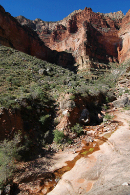
Thirty-four minutes of hiking brought me to the north arm of Emerald Canyon. Emerald's known as a dry canyon so there wasn't even a thought of stopping to look for water. A few minutes later, I passed through Emerald's south arm. An hour later, I was walking slowly with my head down looking for evidence of a trail. Soon after the Tonto entered a broad, open plateau overlooking the unnamed rapids below Ruby Rapids, it just seemed to peter out. I doubled back a few hundred feet but couldn't find an obvious branch or fork in the trail. After reviewing my map, I decided to head off cross country for the head of Quartz Canyon.
This is the nature of Tonto level hiking below the South Rim. Often, the trail is well-defined and easy to follow. Sometimes, there are two or more tracks from which to choose. And on occasion, the trail fades to insignificance or seems to just stop. It's these times when some basic route-finding skills come in handy. If the trail is lost, it's often possible to reacquire by doubling back a few paces in search of signs: a cairn or a second track that appears to have gotten more use. But at those times when the trail remains aloof, there's no need to panic. Just review the map and surrounding features to determine where you are where you're heading. Then, select a track that looks like it might go and follow that line. It's a strategy that keeps you moving forward and often results in meeting up with the Tonto within a short period of time. And that's what I did in this instance.
Fifteen minutes later, I stepped back onto the well-worn tread of the Tonto Trail. This was just north of where the trail crosses Quartz drainage and, on the south side, I found a nice shady spot for a break. Leaving Quartz at 11:45 am, I hiked some 45 minutes before arriving at the head of Ruby Canyon. It was 12:30 pm and I soon found a patch of shade in which to eat lunch. Water was flowing briskly over the Tapeats ledges and I used my collapsible bucket to scoop some from a pool. I used the bucket water to rinse out my shirt and hat. More water was poured over my head and used to wash yellow pollen stains from my legs.
The desert was in full bloom for this hike. The broad plateaus and gentle slopes of the Tonto were dotted by sunny splashes of flowering brittlebush. Hedgehog cactus clusters were adorned with the bright pink bouquets. Fresh Utah agave stalks unfurled towards the sky. Some were ten or twelve feet tall. Indian paintbrush, desert phlox and a host of plants bedecked in a rainbow of colors adorned the landscape. The desert never looked more inviting.
Originally, I had planned to camp at Ruby. But, looking at my trail distances for the next couple of days, I adopted a new strategy. I would wait out the midday sun and heat at Ruby. Then at 5:00 pm, I would leave with a full water supply and a goal of hiking for an hour or so before setting up a dry camp on the Tonto. This would put me a mile to a mile-and-a-half closer to my destination for the next day. I'd be covering that distance during the cool of the late afternoon. And if the strategy worked, I could do the same the following night, which would significantly shorten the longest day of the hike: the trek to Boucher.
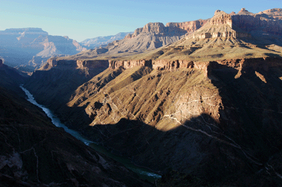
So, I rested my pack on a rock shelf in the shade and settled in for the afternoon at Ruby; an afternoon that included a surprise visitor. It was about 2:00 pm when Robert Petrowski walked down the creek bed to where I was resting. Rob had been exploring up Ruby canyon to the Redwall. He was in the midst of an 12-day hike that started on South Bass, would take him east along the Tonto to Turquoise and back to South Bass. I envied his itinerary, which included layover days at each campsite. This was the first of two night Rob would be at Ruby. We shared stories from our Grand Canyon hikes as the afternoon progressed toward early evening. Eventually, it was time for me to pack up my gear and get back on the trail. We said our good-byes and I left Ruby at 4:30 pm.
Almost immediately, I lost the main trail while climbing out of the drainage. As I tend to do, I went too high and got off track. But after a half-hour of hiking, I spotted the main trail below and chose a track that returned me to the Tonto just before crossing a minor drainage. At 5:38 pm, I reached the point on Le Conte Plateau overlooking the Colorado River. A few minutes earlier, I had startled two bighorn while turning a bend around a small rise. Two rams bounded up the slope and over a ridge. I thought that was that but, while approaching the top of a hill, I spotted the distinctive outline of a bighorn ram head lit from behind in silhouette. He was standing atop a Muav ledge and watched as I continued along the Tonto to my eventual campsite. Later while I was setting up the tent, I noticed the same ram settling in for the night on a small, protected shelf below the ledge.
I awoke at 4:30 am the following morning to water a bush and decided to get an early start to the day. The bighorn that had been watching over me last night was nowhere in sight. After last night's dinner of beef chili mac, I chose cinnamon and spice oatmeal to go with my bagel and peanut butter for breakfast. I hit the trail at 6:30 am and got in a solid thirty minutes of hiking before the sun hit the trail. With the sun out, I stopped in the shade of a large boulder to apply some sunscreen and exchanged my bandana for a hat. Resuming the trail, I passed through the head of Jade Canyon at 7:15 am. I made quick work of the trek to Jasper Canyon, passing through at 7:50 am. Along the way, the trail led me through a typical Tonto plateau cactus field. There were deeply-set boot prints in the soil of this field, suggesting that somebody had passed through during or just after a rain shower.
I lost the trail coming out of Jasper and reconnected some 25 minutes later just before the Tonto turns south across Shaler Plateau. This was a long half-mile stretch of trail across Shaler and pretty easy hiking. Eventually, the trail took a more southwesterly track as it probed towards the head of Turquoise Canyon. Approaching Turquoise, I stepped off trail to check the depths of the canyon and saw several large water potholes below the trail crossing.
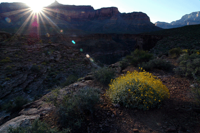
Between South Bass and Turquoise, the Colorado River flows south to north. It's an interesting section of river but one that tested the spirits of the men on John Wesley Powell's 1869 expedition. On August 10 of that year when Powell and his crew arrived at the junction with the Little Colorado River, they had already been on the Green and Colorado Rivers for three months. One of their boats and much of their food had been lost to the rapids. What had been an expedition of discovery had become a struggle for survival. And the foreboding walls of the inner gorge of Grand Canyon served as a daily reminder that they were totally isolated from the outside world. When the river turned northward in its flow, the despair felt by Powell's men was palpable. The river seemed to be taking Powell and his men farther from their destination and their survival in this remote wilderness was never more in question.
Today, hikers like me enter Grand Canyon carrying maps and notes that describe every drainage and plot every reliable water source. We know what lies around the next bend in the river or trail. The risks are manageable which makes it possible to focus more on the canyon's beauty than on her dangers. Though no longer a place of great unknowns, Grand Canyon still has her secrets. And each first hike offers moments of personal discovery. While hundreds--if not thousands--of backpackers have preceded me on this route, it is still my first time through the Gems. The solitude and incomparable beauty of this place refresh a spirit that may have been broken more than a century before.
I arrived at Turquoise at 9:15 am and dropped my pack on a shelf in the shade. Exploring upstream, I found a cool, clear pool of spring water. Just upstream of this, a 10-foot pour off made further progress up canyon more challenging. Returning to my pack, I settled in for a snack and to make an entry in my journal. At 10:15 am after a relaxing break, I left the comfy confines of Turquoise and continued on to Sapphire. My plan was similar to yesterday's: relax at Sapphire during the afternoon then, depart and hike the Tonto to a point east of Agate Canyon where I would camp for the night.
It was 11:35 am when I entered the Sapphire Canyon drainage. The creek bed was dry at the trail crossing but there was flowing water just upstream. After lunch, I spent a quiet afternoon relaxing, filtering water and napping in the shade. I loaded up the pack and left Sapphire at 4:00 pm. My intended destination was a river overlook along the east rim of Agate Canyon. The sun was getting low in the western sky as I followed the Tonto trail south into the side canyon. Following the Tonto Trail through Agate, I stepped into and out of shade. Over one short stretch of trail, my lower body remained in the shadow of the ridge to the west while my upper body was still exposed to the sun. How's that for a chance alignment of star, earth and trail?
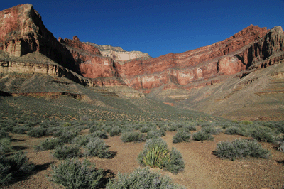
I passed through the boulder-strewn head of Agate Canyon a few minutes before 5:00 pm. Soon after, I was contouring along the east rim, traversing minor drainages and working my way closer to the objective. Coming out of the last drainage, the trail rose towards the crest of a ridge. Once atop the ridge, I could see that I was close to the point overlooking the river. A couple of minutes of walking brought me to a nice campsite near the rim. I dropped my pack and began setting up camp. Dinner was taken on a ledge overlooking the river. I could see upstream to Willie's Necktie Rapids, and downstream to Sapphire Rapids and beyond. I feasted on chicken teriyaki while watching the last light of day paint the buttes across river: Scorpion Ridge, Mencius Temple, Horas Temple, Tower of Set, the broad Coconino- and Kaibab-topped Shiva Temple, and Isis Temple.
My watch alarm went off at 4:15 am and I was on the trail to Boucher less than two hours later. Hiking east along the Tonto trail, I watched as the first light of day cast its soft glow across the canyon. The Tonto cut up and over a ridge leading to a small knob east of Scylla Butte. After cresting the ridge, the trail turned south into Slate Canyon. Slate is one of the largest side canyons on the Gems route and it took a good 45 minutes of hiking to reach the drainage crossing. I arrived at the head of Slate at 8:00 am. There was flowing water upstream of the trail crossing and a nicely shaded grotto in the Schist at the crossing. I spent the next half-hour filtering two bottles of water. At 8:35 am I left the quiet confines of Slate Creek. Boucher Creek was to be my next objective.
This last leg of the hike into Boucher would cover about 3 miles and I estimated 2 1/2 to 3 hours to get there. While approaching the first of two major drainages along the south rim of Slate, I spotted a single pink flowering plant on the far side of the drainage. It was alone in a sea of green-gray shrubs, a jewel set against a plain background. Crossing the drainage, I hiked about 50 meters up trail and dropped down the slope to photograph this beauty. What a treasure!
Continuing the hike, I eventually set boot upon a broad Tonto plateau leading to the second and last major drainage pouring into Slate. The plateau was awash with cactus, which kept my attention focused squarely on the trail. Seemingly out of nowhere, I looked up to see two day hikers--a man and woman--walking towards me. We exchanged, "Good mornings," and stopped briefly to exchange beta. They were out of Boucher and were going, "where ever the trail led." After giving them a brief report on water at Slate, we separated and I continued along the Tonto with a new sense of focus. I was nearing my destination.
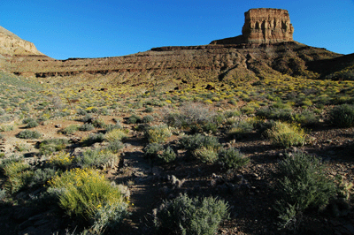
Rounding the point below Marsh Butte, the Tonto turned south-southeasterly along the Colorado River. At ten minutes after ten, I passed through a small boulder-strewn drainage along the face of Marsh Butte. Ten minutes later, the Colorado River came into view and I could see rafts on the water. They were fast approaching Boucher Rapids. I'd felt like taking a break for some time but had been unable to find shade for a rest. Thinking that stopping to watch a river party run some rapids would be better than nothing, I left the trail and made a b-line down slope to a point overlooking the river. There were seven rafts in the group and each one made safe passage through churning Boucher rapids. Below the rapids, the rafts waited for each other and the party continued downstream as an organized unit.
It was 10:40 am when I stepped back on the Tonto Trail. Less than 15 minutes later, the trail began its descent into Topaz Canyon. I entered the creek bed about 20 minutes later at 11:15 am. The friendly gurgle of Topaz Creek offered a soothing tone in the late morning heat. I found a small patch of shade by the creek and filtered some fresh, cool water. After filling both water bottles with sweet Topaz nectar, I headed south across the creek bed into Boucher Canyon. The sun was high and shade almost non-existent, making the trek to the campsites rather unpleasant. Boucher is a hard place on a hot, sunny day.
Eventually, I found Louis Boucher's old cabin--or what remains of it--and knew the campsites should be near. A well-worn path soon brought me to the first batch of campsites and all were taken. I found others in the area, but those that were open had no shade and were well-removed from any flowing water. Tired of walking, I found a wide spot in the trail where I could set down my pack next to a scraggly tree. The tree was partway up a grassy slope and gray shrubs ringed the area. It was after 12:00 pm and I spent the next three hours foraging for shade. I found one spot--an overhang next to the creek--where I enjoyed lunch along briskly-flowing Boucher Creek. All the while, the sun crept further to the west eating away at my patch of cool darkness. I returned to my pack and lay down on the grassy slope, angling my legs and arms to take advantage of the patchy shade cast by the tree.
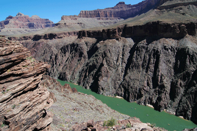
It was 3:30 pm when I noticed a small clump of sawgrass on the opposite side of Boucher Creek. The sawgrass was casting a nice pocket of shade against a large boulder alongside the creek. I walked over and lay down on the boulder, napping for a good half-hour until the sun dropped behind the Tapeats. Cooling shade spread across the creek bed producing a rejuvenating drop in temperature. I spent the next hour writing in my journal and soaking my feet in the flowing water. It was heavenly. But all good things must come to an end and, at 5:00 pm, I decided to head back to my gear and setup camp.
Boucher has a Jekyll and Hyde quality to it. Mr. Hyde is the daytime Boucher; the Boucher of glaring sun, heat and little shade. Dr. Jekyll is the evening Boucher; the Boucher of the setting sun, comfortable temperatures and cool water. This Boucher is idyllic which is why, after setting up my tent, I carried my stove and dinner down to the creek and enjoyed a wonderful meal. After dinner, I washed the trail dust from my legs, arms and face. I used a bandana to soak up water from the creek and wrung the bandana over my head, rinsing the dust and dirt from my hair. I washed several days' worth of sunscreen from my face and even dug out my comb to neaten up. Later after climbing into my sleeping bag for the night, the cacophony of Grand Canyon tree frogs lulled me to sleep. It was pure heaven.
When 4:00 am arrived, my watch alarm let me know about it. Boucher Trail has a reputation as the most difficult of all the trails off the South Rim. I knew the most difficult sections were in the first three miles and wanted to be sure to put as many of those miles behind me as I could before the sun climbed too high. I ate breakfast in my tent and did my best not to make too much noise while breaking camp. There were sleeping hikers camped just 50-feet from me across a small gully. I departed Boucher shortly after 5:30 am. The sun wasn't yet up but the morning light was enough to see the trail.
The trail out of the campsite was well-cairned and easy to follow. Of course, it went uphill at an angle that suggested hard work lay ahead. But it was still early, my pack was light and I was feelling strong. At ten minutes to six, I arrived at the cairned junction with the eastbound Tonto Trail and actually took a few steps along this path. But my instincts told me something wasn't quite right. So, I stopped to admire the view and realized my almost-blunder. Moments later, I'd corrected the error and was back on the Boucher continuing the climb up to the Redwall.
Ascending through the Bright Angel Shale, Muav Limestone and Redwall took about an hour. The last bit through a fault in the Redwall is characterized by a few spots requiring hand and toe climbing with saw grass lining both sides of the route. It was 7:05 am when I arrived at an overhanging shelf just below the top of the Redwall. This made a great location for a rest and snack. Shortly after resuming the trail, I topped out on the plateau below Whites Butte. Now walking in the early morning sun, the trail was flat and easy as it meandered south towards the head of Travertine Canyon.
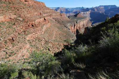
The head of Travertine is where the trail begins its climb up through the Supai. I bopped in and out of the sun for a stretch but eventually the trail settled back into the shade for the bulk of this ascent. On three separate occasions, I thought I'd topped out on the climb only to be greeted a few minutes later by another steep section of trail. But this, too, came to an end and I did reach the start of the Supai traverse just five minutes before nine. Here, the trail turned northwest towards Yuma Point. I paused for one last break in the shade in a minor drainage just south of where the trail rounds Yuma Point. At 9:15, I left this drainage and soon walked back into the sun. There would be very little shade for me, the rest of the day.
Rounding Yuma Point, I couldn't help but stop to admire the view from a very nice campsite on the Supai rim. After my brief sightseeing detour, I returned to Boucher Trail and its southward track deep into Hermit Canyon. Shortly before 10:00 am while hiking this stretch of roly-poly track, I met the four guys resting on their way to Boucher Camp. I knew what lay ahead for them and did not envy their next few hours on the trail. The physically difficult ascent I had made would be a classic knee-jarring descent for them. And they would be negotiating Boucher's last 3 miles during the hottest part of the day and it wouldn't be pleasant. Still, it would probably be worth the effort. Grand Canyon is like that; hard work pays huge dividends.
The track that lay ahead for me was, by comparison, a walk in the park. (Pun intended.) Over the next 50 minutes, I followed the trail deeper into Hermit Canyon until finally arriving at the junction with the Dripping Springs Trail. The junction was in a pinyon pine forest so, I sat in the shade and quaffed a good amount of water before continuing east towards the Hermit Trail. I resumed my hike at 10:53 am and at twenty minutes after eleven, I arrived at the junction with Hermit Trail. What lay ahead was about 90 minutes of hiking up through the Coconino, Toroweap and Kaibab layers. Along this popular section of trail, I met backpackers and day hikers in pretty large numbers. It was a beautiful spring day; a gem of a day for hiking in Grand Canyon.
 |
 |
 |