
 |
 |
|
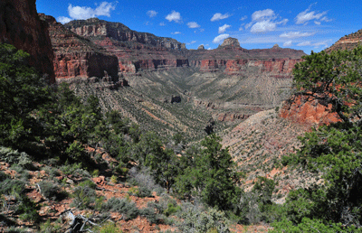
Water is the most precious resource in Grand Canyon. Gold, gems and other treasures stand a distant second to the elixir of life. While a person can survive for weeks without eating, going more than a few days without water will lead to dehydration, confusion, the shutdown of critical organs and, ultimately, to death. When backpacking in a desert environment like Grand Canyon, water is the trinity: first, last and always on a person's mind.
On the night of Sunday, April 17, 2011, I crawled into my sleeping bag with approximately one and a half liters of water to my name. I had started the day at perennially flowing Kwagunt Creek and had broken camp with seven liters of the wet stuff. I normally carry three-to-four liters for a day's hike in the canyon but I wanted to be prepared for a potential dry camp. The extra three liters of water added six and a half pounds to an already full backpack. The hiking was slow and, by 4:00 pm, I had covered just a bit over five miles. But they had been hard, Grand Canyon miles. In trekking from Kwagunt to Sixtymile Canyon, I had gone up and over the equivalent of three Redwall saddles. The breakdown of elevation gained and lost during the day was more than 2,900-feet up and more than 2,100-feet down. In addition to the weighty pack and difficult route, I was still recovering from the previous day's bout with heat exhaustion. As a result, my energy level wasn't up to par. While I had begun the day with thoughts of reaching the perennial flow in Lava Creek, it was clear by mid-afternoon that I wasn't going to get much farther than Sixtymile Canyon.
It was 4:15 pm when I decided to stop for the day and make camp. There was evidence of seeps in the area but I knew the water would be undrinkable. Everyone I know who has consumed Sixtymile water has gotten sick. Filtering, treating and boiling don't seem to make any difference. Something in Sixtymile Canyon taints the water. People who drink it get diarrhea and that is a dangerous proposition for a solo backpacker. To preserve the water I did have, I altered my plans for dinner. Typically, I use about twenty-four ounces of water at dinner. But that would leave precious little for the next day's hike to Lava Creek. So, I ate one of my lunch sandwiches to keep water consumption to a minimum. The one and a half liters in my MSR bladder would have to do until Lava.
So, how did I come to be in this somewhat tenuous situation? To answer that, we need to turn back the calendar a couple of days to April 15. Dennis Foster had kindly offered to give me a ride to the Nankoweap trailhead to start my trip. That Friday morning, we had driven separately to the Backcountry Information Center (BIC) in Grand Canyon Village on the South Rim. I left my Isuzu Rodeo parked at the BIC, where I would pick it up the following Friday or Saturday after completing the expedition. We then drove in Dennis' truck to Saddle Mountain Wilderness Area. From the South Rim, this four-hour drive begins with a stretch along State Highway 64 to Cameron. Turning left at Cameron to head north on US Highway 89, Dennis made another left at Highway 89-Alternate to cross the Colorado River via Navajo Bridge. After crossing the river, we continued on 89-Alternate to House Rock Road and made another left. Dennis expertly navigated this gravel thoroughfare to the Saddle Mountain Wilderness parking area. After a short lunch break, we hefted our packs and hiked three miles on Trail 57 to the Nankoweap trailhead.
It had taken nearly four hours to drive from the Backcountry Information Center to the Saddle Mountain Wilderness parking area and another two hours to hike from the parking area to the Nankoweap trailhead. All together, we covered about 215 miles during those six hours. The straight-line distance from BIC to Nankoweap trailhead is about 21 miles. The flight time for a raven to go from the South Rim to Nankoweap trailhead is between 45 and 50 minutes.
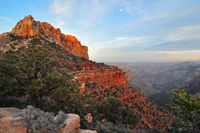
It was just after 3 pm when Dennis and I arrived at the trailhead. There was plenty of time to set up camp and settle in for the night, plenty of time to begin the process of detoxification. Among those qualities of a Grand Canyon backpack I most enjoy, that of cleansing my inner self may top the list. The canyon is the one place I know where, within just a few hours of arrival, the challenges of balancing family, faith and career recede into the background and I am truly able to relax. This process of detoxification is triggered by the quiet. It is not the quiet of absolute silence but the quiet of nature. While simply sitting and enjoying the moment, I became aware of my breathing. Focusing on each breath taken in and each exhale that followed, my breathing calmed to a pace that was slow and steady. The call of a raven touched the moment but this did not disturb the quiet. At intervals, the echoing rumble of a rock tumbling down the steep slope of the canyon head would accent the quiet. The murmur of a crisp April breeze groomed the gnarled pines at the trailhead. I could hear these sounds and they did not disturb. They were calming.
"I just invented a new working definition of the word, calm." Dennis' voice added to the quiet. Like the other sounds, he was not a disturbance. A fellow backpacker's voice is part of natural quiet. It contributes. "Calm, is a place where you can lay down." Of course, we were both laying across the sandstone when he said this. There is truth in Dennis' working definition. You don't lay down in the middle of a rush hour boulevard. It's too loud, the pavement is too hot and hard, and--central to this discussion--a street is not a safe place to recline. By contrast, a back country trailhead is quiet, cool, inviting and safe. Simply put, Nankoweap trailhead is a calm place and great for a midday nap.
Like so many trailheads in Grand Canyon, Nankoweap offers stunning views. Blocky Siegfried Pyre anchored the southern horizon. Closer investigation with binoculars revealed Mary Colter's Desert View Watchtower immediately to the left of the massive butte. Looking further to the left, Gunther Castle stood in silhouette against the sky with Cedar Mountain seen off in the distance. But there was one somewhat perplexing landmark amongst the dramatic forms visible from this point on the north rim. Between Gunther Castle and Siegfried Pyre, stood an unnamed--on National Geographic map #207 of Grand Canyon--peak of approximately 7,600-feet elevation. After some discussion, it occurred to us that this must be the butte named in 2008 in honor of Grand Canyon's greatest modern-day explorer. It was Butchart Butte.
This pristine night at Nankoweap trailhead set the stage for my week-long backpacking expedition through Grand Canyon. Despite the late-winter chill which hung in the air, I managed a good six hours of sleep. Saturday morning, we left the trailhead at 7:27 am, not early but not terribly late for the month of April. About an hour into the hike, we reached Marion Point and stopped for a snack break. Dennis' plan for the day was to see how far he could hike out toward Marion Point. Later, he would return to the rim, pick up his gear and hike back to the parking area to retrieve his truck and drive home. I continued on the trail, going deeper into Nankoweap gorge.
Making good time, I arrived at the creek at 12:31 pm. A group of eight hikers were enjoying lunch beneath the Cottonwood tree that shades the place where the trail arrives at perennially flowing Nankoweap creek. I stopped just long enough to learn that they were planning to continue to the river after lunch. Not wanting to interrupt their meal break, I soon departed to walk upstream in search of a shady spot to eat my lunch. Ten minutes later, I was settling in by Nankoweap creek for an extended break. After eating my usual salami and cheddar bagel sandwich chased by a few cheese crackers, I stripped down to my drawers, donned the water shoes I'd packed for just such occasions, removed the collapsible bucket from my backpack's front pocket and walked out into the sun. Standing beside the creek, I filled the bucket with cool Nankoweap water and doused myself. This action was repeated several times until the trail dust had been washed away. These are the moments Grand Canyon backpackers live for.
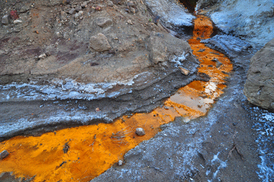
Feeling completely refreshed, I decided to make use of the afternoon by striking out for Kwagunt Canyon to the south. It was a decision that would change the complexion of the hike in ways I hadn't expected. But the unexpected and how a person responds are part and parcel of Grand Canyon hiking. I left Nankoweap Creek at 1:55 pm to begin the passage to Kwagunt. The route follows a natural fault line along a generally north-to-south line roughly parallel to and about two miles west of the Colorado River. Dubbed the Butte Fault by Charles D. Walcott, this fissure offers a route connecting Nankoweap, Kwagunt, Malgosa, Awatubi, Sixtymile and Carbon canyons. I had hiked the stage from Nankoweap to Kwagunt previously in October 2009. But that trek had been undertaken early in the morning of my second day in the Canyon. The warmer afternoon temperatures on this trip--though by no means extreme by Grand Canyon standards--and constant sun were enough to exact a toll. The boulder scramble in the lower half of the drainage leading to Nankoweap Butte saddle took longer than expected. It was twenty minutes to four when I finally emerged from the boulder field onto the relatively flat mid-section of the drainage. I didn't reach the saddle until 5:20 pm and the descent into Kwagunt Canyon took nearly two more hours.
I was thoroughly spent upon finding a good campsite next to Kwagunt Creek. At one point while organizing my gear, a small bug flew into my mouth. The gag reflex was enough to trigger a purging of the contents of my stomach. It wasn't much--mostly water and some trail mix--and I was later able to eat dinner. But this was a clear indicator of the early stages of heat exhaustion. Because of my late arrival at Kwagunt, it wasn't until 9:20 pm that I was finally ready to settle into my sleeping bag for the night. Normally, I would have allowed some time to make a journal entry. Not on this night. I needed rest and almost immediately fell asleep.
Facing a less-demanding itinerary, I may have used Sunday, April 17 as a recovery day. But I had an ambitious schedule to keep. Originally, I had planned to make a dry camp in Sixtymile Canyon on this night. But with the difficult stage into Kwagunt behind me, I set my sights on making it to the next reliable water source, Lava Creek. The night before, I had filtered enough Kwagunt water to fill my primary bladder as well as a secondary four-liter bladder. I used roughly half of that to prepare breakfast and two 20-ounce Gatorade mixtures for the day. Two liters of water remained in the second bladder and I figured this plus the water in my backpack and the Gatorade drinks would be enough for the long day ahead. Guess again.
The day did not go as hoped. I was still recovering from the previous day's bout with heat exhaustion and simply didn't have my usual energy. By midday, I was really dragging. By 12:30 pm, I had been hiking nearly six hours but had gone only as far as the saddle overlooking Awatubi Canyon. During the final stage of the ascent to the saddle, I had needed breaks roughly every 15 minutes just to recover enough energy to continue the climb. I had to do something. That something was to break into my water reserve and start drinking richer mixtures of Gatorade. This seemed to do the trick as I was able to hike longer between breaks and soon recovered my appetite.
The remainder of the afternoon, I made slow but steady progress. However, the energy drought that had started the day and the resulting slow morning pace had exacted a price. By 2:00 pm, I was revising my objective from Lava Creek back to Sixtymile Canyon. I could tell by the weight of my pack that my primary water bladder was less than half full. Trying for Lava in the late afternoon heat could prove disastrous. But if I reached Sixtymile with one-to-two liters of water remaining, that would be enough to get me to Lava during the cooler morning hours of the following day. So, when I found a shaded flat bench on creek right as I approached the junction with Sixtymile, I decided to stop for the day. It was 4:15 pm, which left time aplenty to make camp, enjoy dinner and relax a bit before going to sleep. I also decided to add Gatorade mix to my remaining one and one-half liters of water. Regular sips of the Gatorade mixture would help maintain a good electrolyte balance throughout the morning as I made my way to Lava Creek and the next available water.
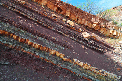
Let me just say that Lava Creek water is awesome! It's cool, refreshing and even tastes good. This can't be said of all Grand Canyon water sources. I just wish Lava wasn't so damn hard to get to. My Gatorade mixture lasted most of Monday morning, April 18. But I did run out of this most precious resource before reaching Lava. I got an early start, leaving Sixtymile at 5:20 am. I took a short break after about an hour of hiking and reached the saddle overlooking Carbon Canyon by 7:11 am. The chill southwest breeze was both welcome and invigorating. During a break at the saddle, I took some photos of blooming wildflowers. Spring was usurping winter's hold on Grand Canyon. I began the descent into Carbon by working my way west to a ridgeline. From the ridge, I could see a clearly defined game trail off to my left (to the east) and decided to adjust in that direction. It didn't take long to contour over to the game track, which I was able to follow about a half-mile until it entered the bed of the main drainage.
Throughout the remainder of the descent into Carbon, each geological layer offered its own unique obstacles. The most challenging were steep and crumbly pouroffs. There were one or two where some may prefer to lower their packs. But these were negotiated by simply sitting and sliding short distances to landing spots below. The final stretch through Carbon is about as easy as canyon hiking gets. The creek bed is packed sand with very few boulders to negotiate. At about 8:55 am a wonderful view of Carbon Butte was unveiled to the west. Shortly after, I started paying closer attention to creek right looking for the exit to the route west to Lava Creek.
Other than being aware of my general location--hiking south through Carbon's amazingly diverse geological environs--I found it difficult to determine where exactly I was. When I encountered a drainage entering Carbon from creek right, I made the decision to head west along its pebbly bed. Was this the route to Lava or had I gone too far south? The disconcerting feeling of not knowing where I was motivated me to exit the drainage and head for higher ground. I was certain this new direction wasn't the correct route, but the view from higher ground would offer a better perspective on my surroundings and yield information that should allow me to solve the riddle of where I was.
At 9:55 am, I took my last sip of Gatorade. Shortly after, I made it to the top of a small hill, waterless. Removing my pack, I sat down to review a map of the area. It didn't take long to orient myself with respect to the immediate surroundings. I recognized an exposed layer cake of rock strata to the north. To the southeast, stood Lava Butte with the higher elevation South Rim peaking over from behind. The hill I had identified as a landmark for the route to lava Creek was off to the northwest. Studying the terrain between me and the hill, I saw a good line of approach. After a few minutes rest, I swung the pack onto my back and resumed the quest for water. The elevated plateau I was hiking was covered with scattered clumps of prickly pear cactus, a few of which were sporting electric pink flowers. Forty-five minutes later, I was standing atop an overlook with a view into Lava. The creek was flowing with gusto and the Still Spring was exactly where I had expected it would be. Ten minutes later, I was in the creek bed and walking alongside the flow toward the Still Spring where I would take an extended break for lunch.
What an amazing place! A shallow pool where the flow from the spring blended into Lava proved the perfect place to lay on my back and allow cool water to wash over me. Later, bucket after bucket of refreshing Kwagunt water was emptied overhead. The next task was filtering water for the remainder of the day. Then, I returned to the shaded area to prepare lunch. To conserve water for this morning's trek, I had eaten a lunch sandwich for dinner the night before. As reward for the modest success of arriving at Lava, I ate the previous night's planned dinner for lunch. After my meal, I explored the area around the spring but did not find the old still. Feeling a bit disappointed, I found a spot in the shade where I could lay down and take a nap. The combination of the bath, a big lunch and rest completed my recovery from the miscalculation of the first day. At 1:45 pm with a feeling of renewed energy, I left the Still Spring to continue up Lava Creek in search of a good campsite for the night.
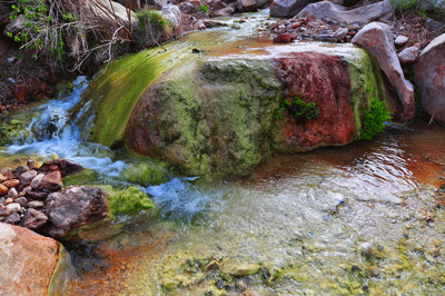
The hike up Lava Creek, like so many stages on this backpack, offered slow but steady progress. Rather than shortcut bends in the creek, I stuck close to the water where trees offered shelter from the afternoon sun. I must have passed fifteen or twenty small water falls over the course of the afternoon. Each seemed more idyllic than the last. Over the course of this three and a half mile trek, Lava subtly gained about a thousand feet in elevation. And the character of the creek evolved in interesting ways. Along much of this upstream pathway, the waters remained crystal clear. But upon entering the riparian zone at approximately 3,900-feet elevation, a gradual enrichment of green emerged. More ferns and other plant life were growing on the rocks within the creek. Emerald green algae also appeared and filled the creek as carpeting might fill a hallway. Eventually, I entered a new riparian zone at about 4,300-feet. This zone was characterized by iron-rich minerals that painted the creek bed a rich, rusted hue.
It was nearing 5:00 pm when I arrived at the gushing emergence of Lava's primary water source. The source is a spring that pours forth from a jumble of boulders forming a minor obstacle in the creek. Above the spring, the canyon opens up a bit. The creek bed is dry so the surrounding environment is closer in personality to the familiar desert landscapes of the canyon. It was on the creek right side of Lava near the source spring that I found a place where I could pitch my tent. And so I set up camp and settled in for the evening. After dinner while organizing myself for the day to come, I was very focused on the morning's challenge of finding a route through the Redwall to the saddle that connects Lava and Unkar canyons. This would prove to be the most difficult challenge of the trip. In hindsight, this was arguably the most challenging route of any I've hiked in Grand Canyon.
I knew Tuesday, April 19 would be a hard day. My research of the route from Lava Canyon over the Redwall saddle into Unkar Canyon indicated there were two options from which to choose. One could stick to the drainage and boulder hop to the Redwall or take to the high ground and fight the dense vegetation. Neither option was entirely attractive. The climb from my camp in Lava Creek to the Redwall saddle would cover a relatively short distance of about one and a half miles. But understanding that Grand Canyon miles are different, I had estimated three hours for this section of the hike. In the end, it took nearly seven hours to reach the saddle.
The day started with a very quick breakfast and an expedited packing of my gear. The catalyst for the quickened pace was the mosquito swarm that proved a constant bother. They launched their assault from an improbably large and deep pothole residing below the boulders that defined the eastern boundary of my camp. It was 6:36 am when I left the swarm behind to begin my advance through the Tapeats rubble field south of the creek bed. Once through the Tapeats, I emerged onto a drainage plain and was greeted by a view of the Redwall that was not what I expected. There was no fault, no possible route through this barrier and that meant just one thing. I wasn't where I needed to be. After consulting my maps and a printed photo of the correct Redwall route, I realized the error. I needed to be in the next drainage to the west and so, I bushwhacked through the manzanita, trees and scrub to get around a Tapeats point into the next drainage.
Sure enough, there was a route through the Tapeats on the other side and I slowly made my way up following clear patches and the occasional game track. I trended right (west) because reports indicated the route through the Redwall to the Lava-Unkar saddle should be on the right. Eventually, I came to a high point with a clear view of the drainage plain and the Redwall. Again, the view was unexpected. First, Juno Temple was nowhere to be seen. This Grand Canyon monument is prominently featured in a photo I had been sent as a reference for the Redwall route. Was this not the correct drainage? Everything else looked as it should but Juno Temple wasn't there. Eventually, I decided that the person who sent me the photo had added Juno in Photoshop. It was the only viable explanation for what I was seeing.
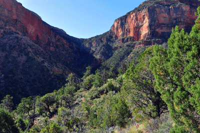
The second realization was that I had come too high and too far to the right. There was a monstrous bay I would have to traverse if I stayed at this elevation. So, I decided to descend to an alternate route. Below, I could see a boulder-filled drainage channel that looked clear of scrub. The boulder hopping might be a slog but I was more interested in leaving behind the bushwhacking. I didn't want to immediately lose all the elevation I had gained so, I angled generally east by southeast while working my way about 300 feet down into the channel. The hiking in the drainage was so much easier than the struggle through the bush. Then, I realized this channel led to the west bay and would terminate at the base of the Redwall. Again, I was in the wrong place. I scouted for an exit to the east but was stymied by dense vegetation at nearly every turn. Finally, I decided to take my lumps and force a route through the dense growth. That was fun.
Once out of the channel, it was constant bushwhacking broken only intermittently by short game tracks that eventually led to more bushwhacking. It was a total slog. Seconds became minutes and the minutes yielded to hours. I lost all sense of time and, when surrounded by the impenetrable growth, all sense of location. Occasionally, I would catch a glimpse of the Redwall and adjust my direction accordingly. All this time, the manipulated photo was still playing on my mind. Was I in the right bay? Nothing about the route or the objective was certain. I encountered and used no fewer than three different boulder fields. As each approached its head end in the Redwall, the going became dicier and I had to exit to the east.
Towards the end of my advance, it looked as though I should be high enough in elevation to be even with or slightly above the Redwall saddle. I decided to trust my gut and broke off to the east. Sure enough, when I entered a small clearing I could see the saddle about fifty feet below. And there was Juno Temple off in the distance. It is clearly visible from the saddle but this iconic landmark is nowhere to be seen from the approach route below the saddle. When I arrived at the saddle, the time was 1:15 pm. Nearly seven hours had passed since I'd left camp. When planning this day, I had entertained the notion of hiking down Unkar to explore the ruins at the Colorado River. But with the long descent into Unkar still ahead, I scrapped those plans for another objective. I would continue to the north-south arm of Unkar, and head down that channel in search of water and a place to camp.
The descent into Unkar was a walk-down that presented just a few minor obstacles. It was a long trek but a walk-down, nonetheless. Three hours after leaving the Redwall saddle, I arrived at the Tapeats pouroff that needed to be bypassed on the left. The most challenging aspect of this detour was the boulder chute that led back into the main drainage. It was 4:35 pm when I re-entered the fault and another thirty minutes of hiking brought me into Unkar's main arm. From here, I angled left and started walking downstream with confidence that I would find flowing water within an hour at most. The north-south arm of Unkar is the widest channel I've hiked in Grand Canyon. It must be amazing to be here--from the safety of high ground--when Unkar is filled by the swollen flow of a heavy winter run-off. If there was ever a time when Unkar was perennial and filled to capacity year-round, that must have been something to behold.
At just after 5:30 pm, I entered a zone where a gentle foot-wide flow of water emerged and headed toward the river. It wasn't the full gushing flow I had hoped to find but was more than enough to suit my needs. This spot with its slickrock shelves would make a fine camp. Best of all, there was still time to wash up before dinner. It was late enough that the air had taken on something of a chill. But that didn't stop me from straddling the creek, soaking up water with my neckerchief and wringing the contents out over my head. I also rinsed off my arms and legs. It was good to feel something akin to clean, again. While rinsing away the trail dust, I was surprised by two backpackers walking upstream toward my camp. Jeremy and Troy were making their way up from the river after spending the last two days exploring the Ochoa-Unkar region. We chatted while I finished setting up camp and they filtered water. Coincidentally, all three of us would be hiking in the same direction to start the next day: heading up and over the Redwall saddle from Unkar into Vishnu Canyon.
April 20, 2011 was my fifth day below the rim and it proved to be another long day of backcountry route-finding. I left the gentle stream at 6:13 am and began heading back upstream to the junction with the fault line. Following the fault line to the southwest would lead to the Redwall saddle that connects Unkar with Vishnu. About 25 minutes into the day's hike, I reached the spot where Troy and Jeremy had decided to make camp the previous night. They were just waking up and, after a brief exchange of, "Good mornings," I continued on my way wondering how long it would take them to catch and pass me. As it turned out, not very. The advance through Unkar to the saddle was fairly straightforward. About a half mile from the junction with Unkar's main arm, the fault line encounters an impassible Tapeats pouroff. There is a fairly obvious bypass route on the left, which required about 50 minutes for me to negotiate. It involved some minor climbing but nothing technical. Once up the bypass chute, I angled across and down slope to return to the creek bed.
Hiking the last mile to the saddle, the drainage became more choked by boulders and slowed my progress. I decided to take a break in a spot of shade at about 9:45 am. Just as I was preparing to resume the hike toward the Redwall, Jeremy cruised up from behind and passed me. Not too long after--ten minutes, perhaps--Troy approached. While going by, he offered a bit of advice about possibly needing a rope just below the saddle on the descent into Vishnu. Watching the two of them move so quickly and easily up the creek bed, I wondered if I was that fast and strong in my mid-20's. It's hard to know since I wasn't into hiking, then. Cycling was my thing. In any event, I'm definitely not that fast and strong, today. But I'm fast and strong enough.
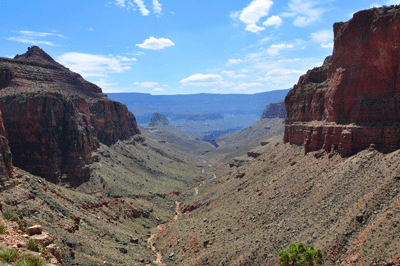
The climb up through the Redwall was challenging. There were a couple of places that had me stymied at first. But I deduced the correct routes and arrived at the saddle overlooking Unkar to the northeast and Vishnu to the southwest at 11:35 am. I ate lunch atop the Redwall, consuming the spectacular views along with my sandwich. Juno Temple and the North Rim anchored the view to the northeast with Vishnu Temple and Krishna Shrine defining a spectacular vista to the southwest. Being rewarded with such stunning landscapes is a reminder why people become obsessed with hiking Grand Canyon. By contrast, the descent into Vishnu was long and tedious. Not too far below the saddle, one must follow a ledge on the right around and into a drainage emptying from Cape Royal into Vishnu. Once around the corner, it was a matter of deciding when and where to abandon the ledge and negotiate the tricky descent into the main bed of the drainage. I probably should have stayed longer on the ledge. The talus and boulder strewn slope I chose could hardly have been more treacherous. Each step had to be carefully evaluated and one misstep could have been disastrous.
It was 2:26 pm when I entered the drainage bed leading to the main bed of Vishnu. Fifteen minutes later, I was in the main bed. Ten minutes after that, I encountered the first pothole water in Vishnu. The flow rate increased steadily throughout the next hour. With each pouroff, the amount of water seemed to increase. This lasted until just above the Shinumo Quartzite narrows, at which point Vishnu Creek became dry as a bone. It was just above the narrows that I decided to the leave the creek for the Tonto platform. My goal for this day was to find the place where Dennis and I had found water and made camp the day after the rockslide that effectively ended our March 2010 backpack. I knew I needed to be higher and used a contouring line through two minor bays to gain that elevation. After crossing the second of these bays, I hiked up to a ridge to gain a vantage point into the next drainage. The view from the ridge offered a sweet reward. I'd found it!
A cluster of trees revealed the location of the spring at the Muav contact that serves as the source of the water flow in this drainage. Looking below the spring, I could see the place where I had spent the better part of four days awaiting evacuation from the canyon. It was exactly as I remembered it. A narrow shelf provided just enough space for a one person tent. Water flowed by along the north side of this shelf and over a small fall with a shallow collection pool at the base. Soon after arriving, I had undressed and walked down to the collection pool with my collapsible bucket. Several dousings later, I was feeling refreshed and human, again.
It was a nice change of pace to have an abundance of time to set up camp and make dinner before dark. Two rocks I had used as anchors for my tent in March 2010 where exactly where I had left them. In fact, I found a length of cord that had unintentionally been left behind when the rangers came to airlift me to the South Rim. I packed the chord out as a memento. In hindsight, my interest in returning to this very site was probably the driving force behind my doing this backpack. To return to this spot, spend a night and then leave--all on my terms--has brought a real sense of closure to that misfortunate March 2010 hike. Besides, I really like this place. It's a sweet little oasis in the desert.
Later that evening while making my daily journal entry, I weighed the options for my sixth day in Grand Canyon. While developing the itinerary for this stage, I had intended to go for the small beach campsite just upstream of the mouth to Clear Creek. However, reviewing the notes on the descent route from the Tonto platform down Eightythree Mile drainage to the river, I started to re-think this strategy. Several people reported needing or using ropes to lower packs through the Schist. Perhaps, if I had not been hiking solo, this route would not have given as much caution. But having no experience with this descent and estimating a mid-afternoon window for negotiating it, I decided to pass. Two options remained. One, was to follow the high saddles route from Vishnu to Clear Creek. The other was to stay at the Tonto level, hike around Angels Gate and The Howlands to Clear Creek. I opted for the second of the two.
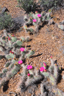
The Tonto platform is like a storm-tossed sea that has become frozen in time. A single moment--complete with the undulations and chaos of random rolling waves--has been locked into the landscape. You cannot fight the Tonto. Rather, find a rhythm with its undulating terrain and simple flow with it. Approaching the bed of a side canyon, be prepared to lose elevation before entering the bed and to gain that elevation back on the exit. On wide open flat expanses, it's best to set an easy pace; one you can maintain for an extended period of time. You're not getting anywhere in a hurry on the Tonto so, settle in for the long haul. Of course, there are times when the Tonto won't cooperate. The slopes between drainages can be steep. The angle can force you to constantly gain elevation just to avoid the rim. Boulder-choked drainages can be challenging to cross at almost any point. At other times, the Tonto surprises with a treat. It can be a small thing like a creek bed crossing that requires no significant elevation change. Or maybe a long stretch of hiking across sparsely populated fields. The Tonto has more cactus needles per square meter than New York City has people per square mile. It's a treat to cross a field where the rocks outnumber the cactus.
After nearly a week of working hard just to hike six or seven miles in a day, I consumed roughly twelve miles on this day. About ninety minutes after leaving camp, I rounded the southern point of Hall Butte and soon located a descent route into the nameless side canyon to the west of Vishnu. Though nameless, this canyon is not unknown. It has earned a few popular nicknames, one of which is appropriate in a public forum, "Double Disappointment." It took half an hour of careful hiking to negotiate the ramp through the Tapeats and reach the creek bed. There was no water, not even the hint of a flow. After a fifteen minute break to apply sunscreen and enjoy a snack, I began the trek up canyon to look for an exit. Ahead on my left, I spotted a ramp ascending between the Tapeats and a tower that had broken off from the rim. While I couldn't see what lay around the bend, the route looked promising enough to be worth exploring. Forty minutes later, I stepped back onto the Tonto platform and set a course for Hawkins Butte.
The Tonto was bursting with life. Prickly pear cactus were bejeweled by their iconic pink bouquets. Agave stalks strained toward the sky and yucca stood adorned with bunches of yellow blossoms. I also studied the landscape on the other side of the Colorado River. Among the rewards of Tonto level hiking, are the wide open views that do more than almost anything to convey the overwhelming depth and breadth of Grand Canyon. For the first time on this hike, I had a clear view of the South Rim, and the familiar buttes and mesas that define her character. To orient myself, I looked for and identified Horseshoe Mesa which was off to my left to the southeast. Farther in the distance, The Sinking Ship and Coronado Butte rose from the southside Tonto. Off to the southwest, Pattie Butte and the ridge connecting it to the rim obstructed the view further downstream. My progress remained constant and steady throughout the morning. Knowing that shade would be hard to come by, I took advantage of a sheltered drainage below Hawkins to rest for forty-five minutes and eat lunch.
The next stage of the day's hike was just plain tedious. The nameless canyon that drains the Tonto from just below Angels Gate to Eightythree Mile Rapids seemed to go on forever. Every curve and corner should have revealed the head of the drainage but they revealed only more canyon. It's during such seemingly endless stretches that the mind does things to fill the time. I like to sing, sometimes songs I know and at other times songs I make up. These activities are fun and help pass the time. They can also soothe the soul. Here's one of the songs I composed while hiking the Tonto.
Have a little faithI've got a notion this would be a good piece for the children's choir at my church.
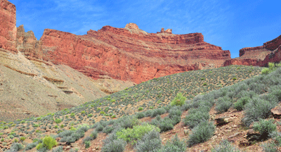
It was just before two o'clock when I finally arrived at the head of the canyon below Angels Gate and turned the corner to begin heading west to Clear Creek. A long hour and fifteen minute stretch brought me near the eastern rim of that water-filled canyon. I turned another corner to begin walking north with two hours of good daylight ahead of me. Across the chasm of Clear Creek, Zoroaster Temple dominated the skyline. This is a landform that never fails to impress. Seeing it for the first time from this vantage point, I gained new respect for the mammoth natural monument. The more distant Brahma Temple seemed to be standing side-by-side with Zoroaster. Off my right shoulder, The Howlands Butte rose high and proud from the Tonto platform.
Rounding the northern point of The Howlands Butte, I decided to make camp in the large drainage ahead of me to the east. It was about 5:15 pm and I was spent. Today's twelve miles across the Tonto had taken nearly as many hours to complete. I'd left Vishnu with about seven liters of water and was approaching my final destination for the day with about two liters remaining. It would be a dry camp and most likely my last camp of this trip. Not too worry, I would probably get to Clear Creek and its perennial flow of crystal clear water within an hour or so of breaking camp in the morning. A half-liter would be more than enough to get me there. With that understanding, there was no reason not to enjoy my usual evening dinner of a Pro Pak meal and a cup of hot apple cider. This is the kind of dining that has minimal appeal at home in Flagstaff but, after a long day's hike in Grand Canyon, this is the stuff of dreams. I was really looking forward to freeze dried on this night.
Friday, April 22 was the eighth and last day of this hike, and my seventh below the rim. My permit included a last night in the Clear Creek use area but I was ready to go home, to hug my wife and son, and sleep in my own bed. It would be another long day on the trail. The march from the drainage below The Howlands to the South Kaibab trailhead covered about eighteen miles. This was easily the second-longest hiking day I've had in Grand Canyon. I woke early, enjoyed a light breakfast, packed and was on the trail by 5:45 am. Within five minutes, I picked up the first cairns marking the descent route through the drainage leading to the east arm of Clear Creek Canyon. The route was well-marked and straightforward to navigate. Once into the bed of the drainage, there were a couple of bypasses--including one that included a fun section through the Schist--but this is very doable for a moderately experienced Grand Canyon hiker.
An hour after hitting the trail, I arrived at fully flowing Clear Creek and selected a spot on the slickrock to drop my pack. The tasks at hand were to wash up a bit and filter enough water for the hike to Phantom Ranch. I have to say, Clear Creek water is among the best tasting and most refreshing fresh water in Grand Canyon. It is chill and crisp, and doesn't have any funky aftertaste. This stuff is the champagne of the canyon. After topping off my primary bladder and preparing two bottles of Gatorade mixture, I tightened the boot laces and resumed the trail. It was 7:35 am when I left the watering hole. Passing through the designated Clear Creek campsite, I met another solo backpacker. We chatted for quite some time. This was, after all, only the third person I'd seen in the last week. But I still had a lot of miles to cover so, at about 8:15 am, I continued up trail.
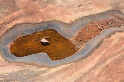
It's amazing how easy trail miles can seem after spending the better part of a week bushwhacking routes through the backcountry. The Clear Creek and South Kaibab trails are Grand Canyon's equivalent of an interstate highway system. Clearly defined and well-groomed, they offer fast access to the backcountry below the rim. It was just about 8:40 am when I finished the initial climb to the Tonto level and began, in earnest, my assault on Clear Creek trail. Four hours later, I entered the Phantom Ranch Canteen. Along the way, I enjoyed the fast-track nature of this very well groomed trail.
It was just after ten o'clock when I rounded Demaray Point to complete the first stage of the hike. Past Demaray, the trail turns and takes a westerly tack. Knowing how precious shade is along this trail, I stopped for a short break in the first drainage west of Demaray Point. After that, it was time to resume the trail. It was somewhere below Bradley Point that I met a couple of teachers enjoying their rest in the shade. I wonder if the giddiness I felt over enjoying a conversation with other people was as tangible to them as it was to me. Although they were the only two people I encountered between Clear Creek an the Canteen, the encounter helped ease me back into civilization.
The joy of trail hiking in Grand Canyon is the joy of stretching your legs, quickening the pace and putting miles beneath your boots at a fast clip. It's the joy of consuming Grand Canyon the way a child would eat a bowl of chocolate ice cream: in great heaping mouthfuls. With the Clear Creek trail in the best condition I'd seen, I was able to set the cruise control on go. Arriving at the junction with the North Kaibab trail at 12:31 pm, I made the left turn and set a course for the Phantom Ranch Canteen. Fifteen minutes later, I deposited my pack on the bench outside the front entrance and walked inside for a Lemmy. the Lemmy is undoubtedly one of the great inventions of humanity. It is among those things that separates us from the beasts of the forest.
Air conditioning is another. It is impossible to describe the truly marvelous wonder that is air conditioning. After eight days without electricity, potable water or Internet, air conditioning seems a little like voodoo magic. It was certainly appreciated while I ate my lunch in the Canteen. Afterwards, I stepped outside to take a nap on the bench. My backpack had to suffice as a mattress. I don't know if I actually slept. It felt more like suspended animation, as if simultaneously asleep and aware of the world around me. It was a conversation between three backpackers that teased me back to reality. They had put in two gruelingly long days, already, and were lamenting the long hike out from Phantom Ranch that awaited the next day. From personal experience, I knew they had no idea what a truly long day in Grand Canyon could mean. But I did have genuine sympathy for them. Everybody's first hike in Grand Canyon should be wondrous. From the conversation I overhead, theirs was becoming something of a forced march.
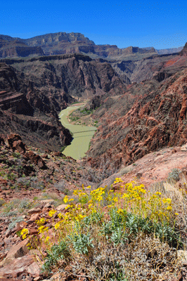
"Kaibab Juice" is my name for the liquid concoction that fueled my ascent of South Kaibab trail on this day. These were the last seven of the eighteen miles I hiked, and the hardest. Kaibab juice consists of two liters water, one packet of orange flavored Vitalyte mix, one large Lemmy and ice to fill a four-liter bladder. Shake well and drink in healthy sips while hiking out Grand Canyon along the South Kaibab trail. This mixture remained cool and invigorating throughout the nearly four hours of my trek from Phantom Ranch to the rim. Along the way, I took just one short break. But throughout, I was taking stock of what I'd accomplished and gained in doing this hike from Nankoweap to the South Rim.
This was, without question, the hardest hike I've done in Grand Canyon. The first day set the tone. Perhaps, I shouldn't have continued from Nankoweap to Kwagunt. Regardless, I did make the hike to Kwagunt and ended up paying a stiff price. I endured a mild case of heat exhaustion, which limited my stamina for the next 48 hours. Who knows how that impacted my judgment. I hiked approximately 30 miles the last two days. Clearly, I had recovered sufficiently from the first day's heat exhaustion to put in some long days. But this also reveals a real desire to get home and be with my family. In-between, the hike from Lava to Unkar was simply grueling. Everything about that morning was a living nightmare; a real slog. In hindsight, the experience I had illustrates a need to develop improved route-finding skills. I need to get better at hiking Grand Canyon before taking on the next big, solo adventure.
This was also an incredibly satisfying hike. To find the location where I spent the better part of four days in 2010 awaiting evacuation, to spend a night there and to leave the following morning on my own terms was an experience that brought much-needed closure to the ill-fated March 2010 backpack. To face and to meet the challenge of several difficult stages in Grand Canyon was definitely satisfying. And to finish the trip by hiking eighteen miles from the Tonto level just below The Howlands to the South Kaibab trailhead was immensely satisfying. I may never want to do a hike like this, again. But I'll never forget it. Or regret it.
 |
 |
 |